Oppenenauchack — Place of the Oyster
Long before the name Apponaug appeared on any map, this crossroads at the head of the cove sat along the Old Pequot Path, the trail that linked Narragansett settlements around the bay. The Narragansett had camped and traveled along it for roughly two thousand years before European colonization ever reached these shores.
When Roger Williams passed through in 1636, on his way to a trading post near present-day Wickford, he wrote down what the Narragansett called this particular bend of shoreline: Oppenenauchack — oyster. He noted that shellfish here were so abundant that a traveler could gather them freely along the way. Colonial writers spelled the name as they heard it — Aponahock, Aponake — as early as 1663, and it eventually settled into the Apponaug of today. The cove has carried the same meaning under every spelling: a place where oysters were simply there for the taking and where Apponaug translates to The Place Of Oysters.
Two Thousand Years at the Water's Edge
In 1954 and 1955, the Narragansett Archaeological Society excavated Sweet's Meadows, a low rise above a small spring-fed brook that still empties into Apponaug Cove. Its director, William Fowler, described a campsite people kept returning to — from roughly 100 B.C. to 1600 A.D. — a run of use long enough to leave real weight in the ground.
What the dig turned up was, quite literally, dinner: the shells of oysters, quahaugs, sea clams, scallops, whelk, and razor clams, layered into the soil over fourteen centuries. It is the kind of evidence that doesn't need much interpretation. People camped here because the cove in front of them never stopped giving up shellfish — the same fact Roger Williams would write down, in one word, sixteen hundred years later.
The Shanty Men
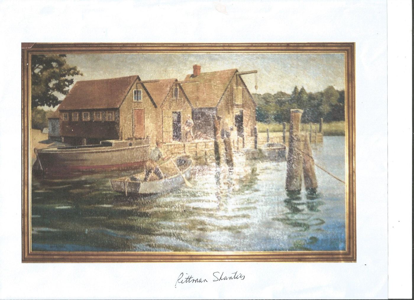
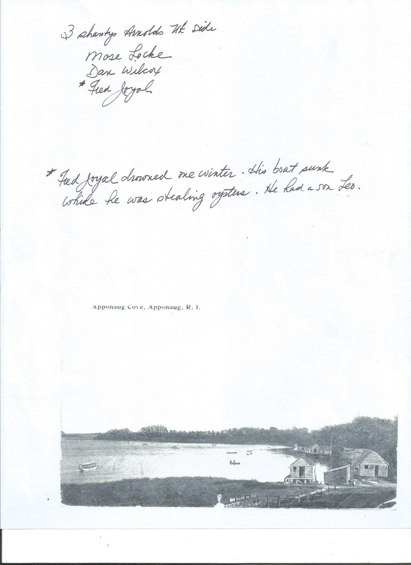
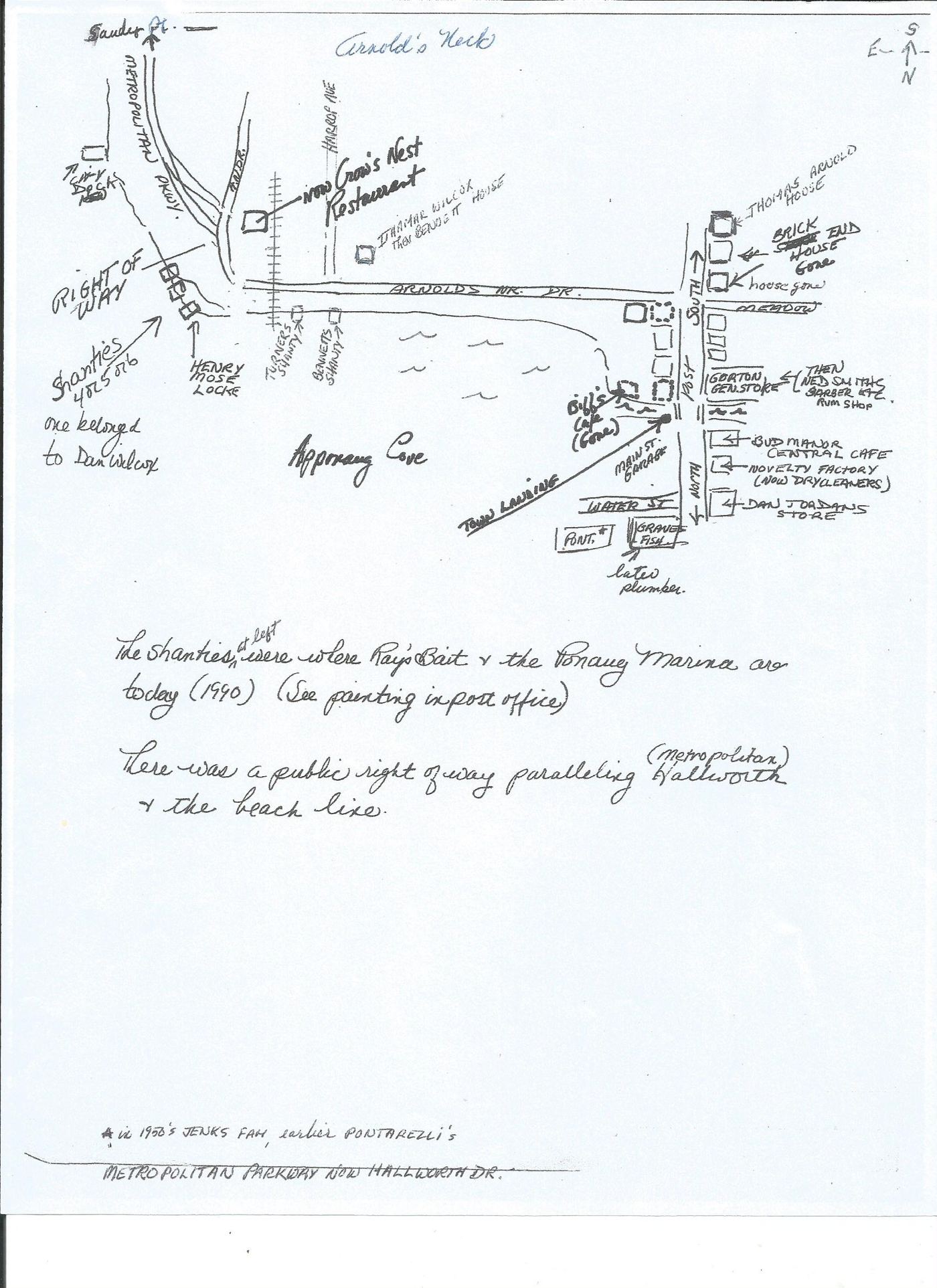
By the turn of the twentieth century the shoreline of Apponaug Cove was lined with small wooden shanties, built out over the water on pilings — half workshop, half warehouse, where oystermen, quahoggers, and scallopers landed, sorted, and shucked the day's catch before it went to market. They stood in two loose rows: one off Station Street on the cove's south side, another along the Metropolitan Parkway — the road known today as Hallworth Drive — toward Arnold's Neck.
Station Street row
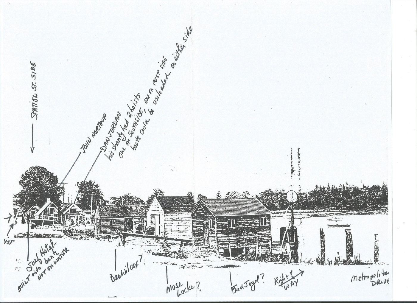
- Dan JordanHis shanty carried two hoists — one on the south side, one on the rest — so a boat could unload whichever way the tide ran.
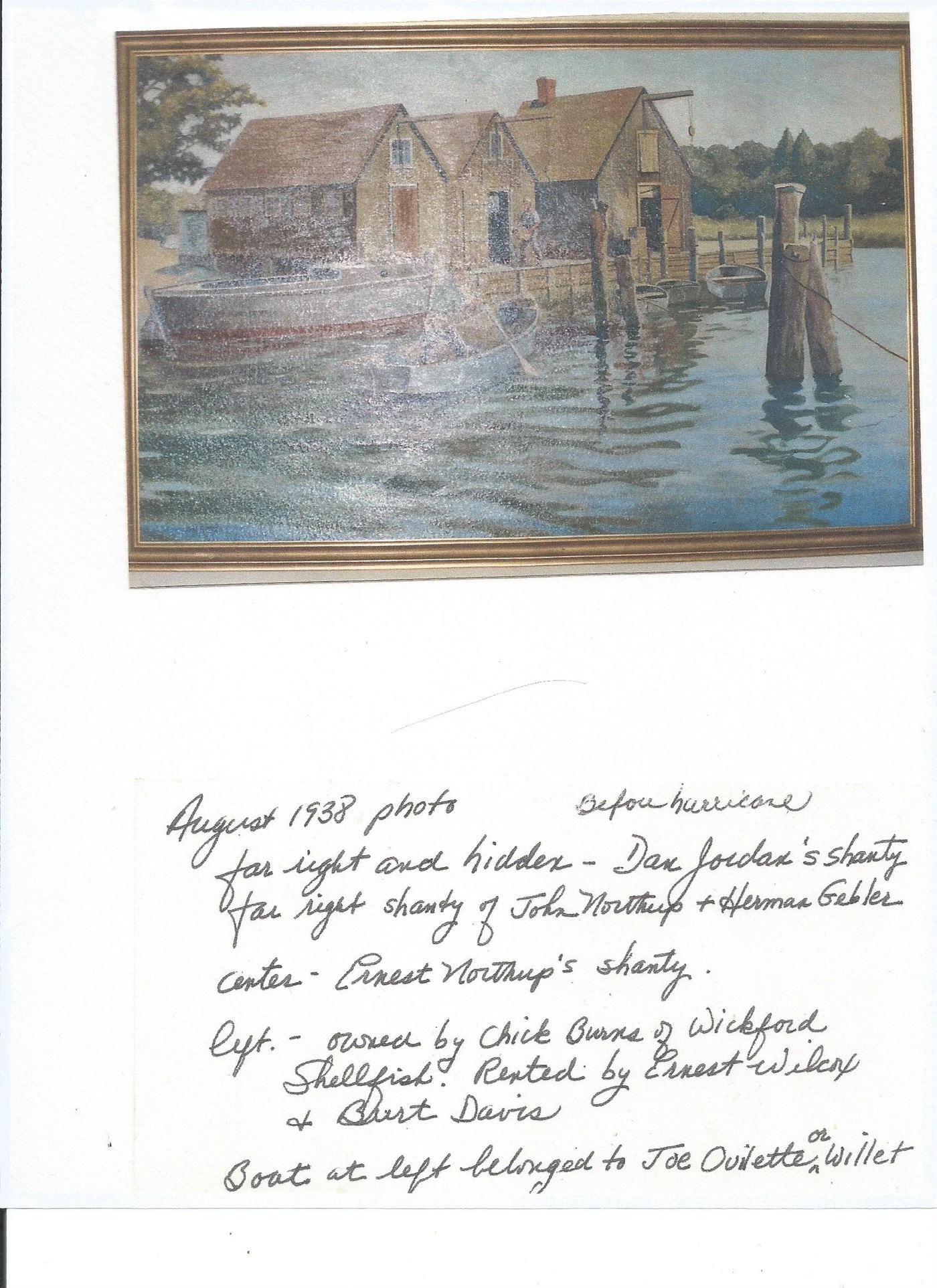
- John Northup & Herman GeblerShared a shanty on the row, visible at far right in the 1938 photograph below.
- Ernest NorthupShanty at center of the row.
- Ernest Wilcox & Burt DavisRented their shanty from Chick Burns of Wickford Shellfish.
Arnold's Neck side
- Mose LockeOne of three shanties on this shore, reached by a public right-of-way running parallel to the beach.
- Dan WilcoxHis shanty stood alongside Locke's and Joyal's.
- Fred JoyalDrowned one winter when his boat went down while he was out for oysters that weren't his to take. He left a son, Leo.
- Charlie Turner & the BennettsTurner's and Bennett's shanties stood nearer the Crow's Nest end of the cove, on the same north shore.
One shanty on Station Street, run by the Wilcox family, handled quahogs and scallops well into the twentieth century — the same building whose last piece would still be standing, alone, in 1987 (see The Last Shanty, below). A few miles south on Greenwich Cove, the Drew Shanty followed nearly the same arc: built first as a scallop-shucking house where workers were paid by the measure, later converted for welding bullrake frames, and today kept by the Drew family for recreation rather than work. Up and down this stretch of bay, the shanty rarely stayed one thing for long.
Before the Storm
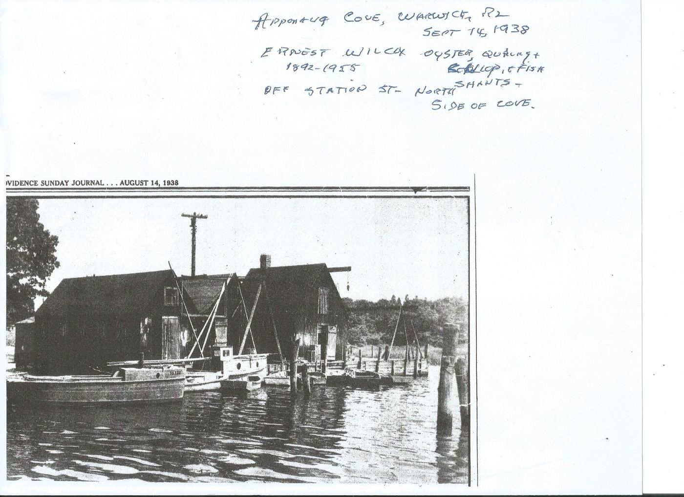
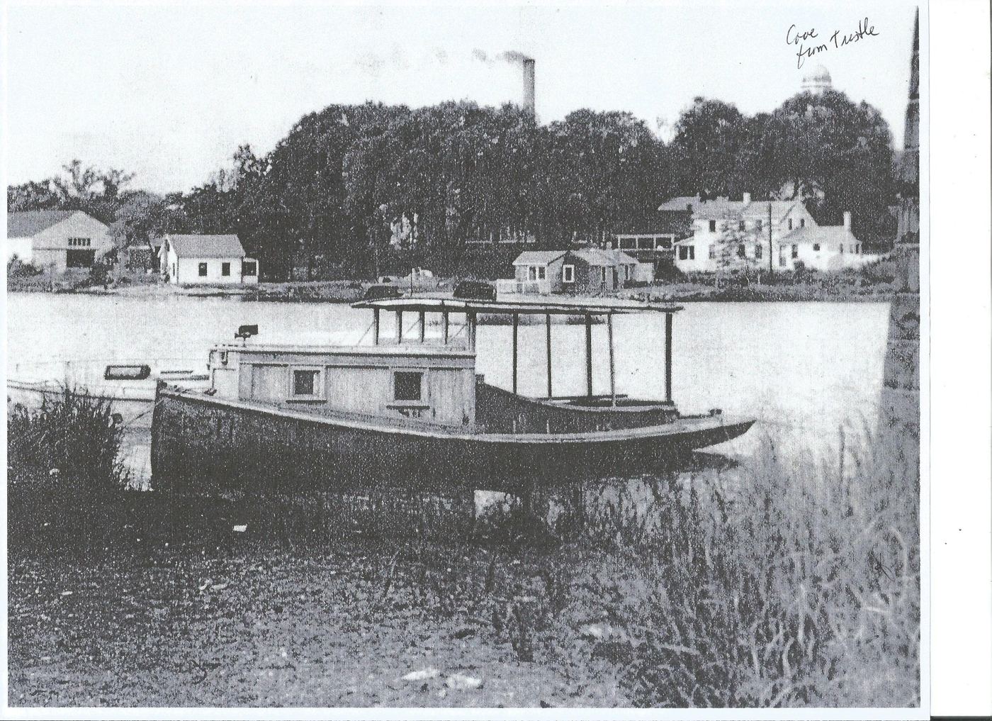
A photograph made in August 1938 — a month, as it turned out, before the Great Hurricane tore through Narragansett Bay — shows the row still whole. Jordan's shanty sits at the center with its two hoists; the Northup and Gebler shanty stands beside it; at the far end is the shanty Ernest Wilcox and Burt Davis rented from Wickford Shellfish. A rowboat tied at the pilings is remembered, in one hand, as belonging to Joe Ouellette, and in another as Willet's — family memory rarely agrees on everything.
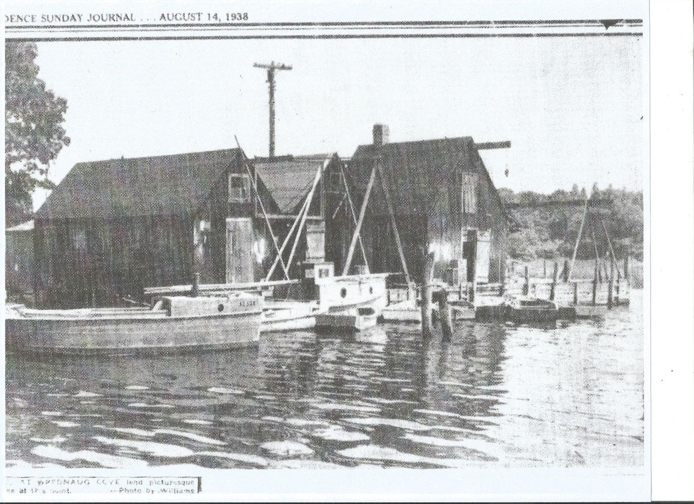
That same summer the Providence Sunday Journal sent a photographer named Williams down to the cove and ran its own view of the row — the E. Wilcox operation that had worked the north shanties off Station Street since 1892.
The Last Shanty
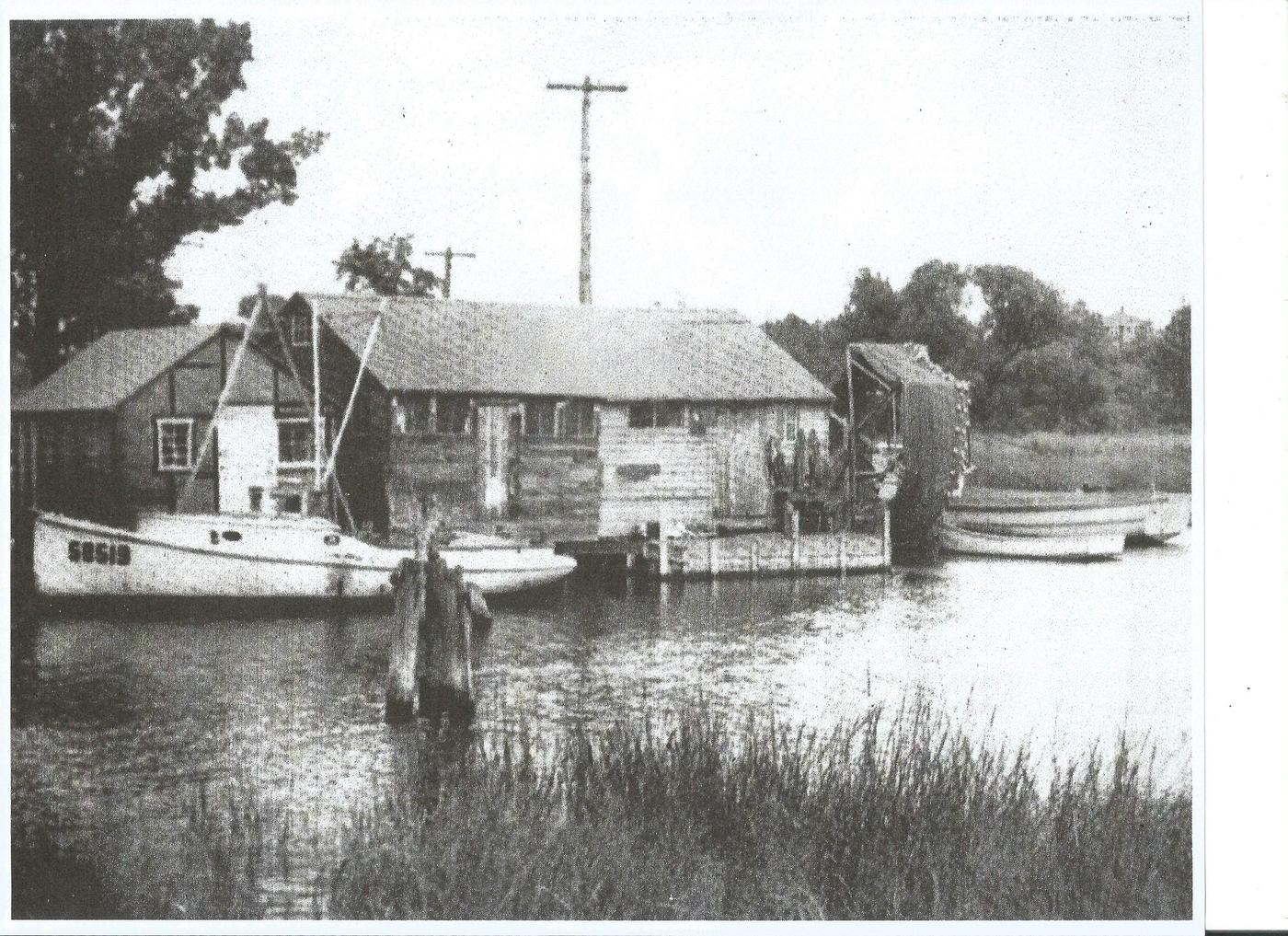
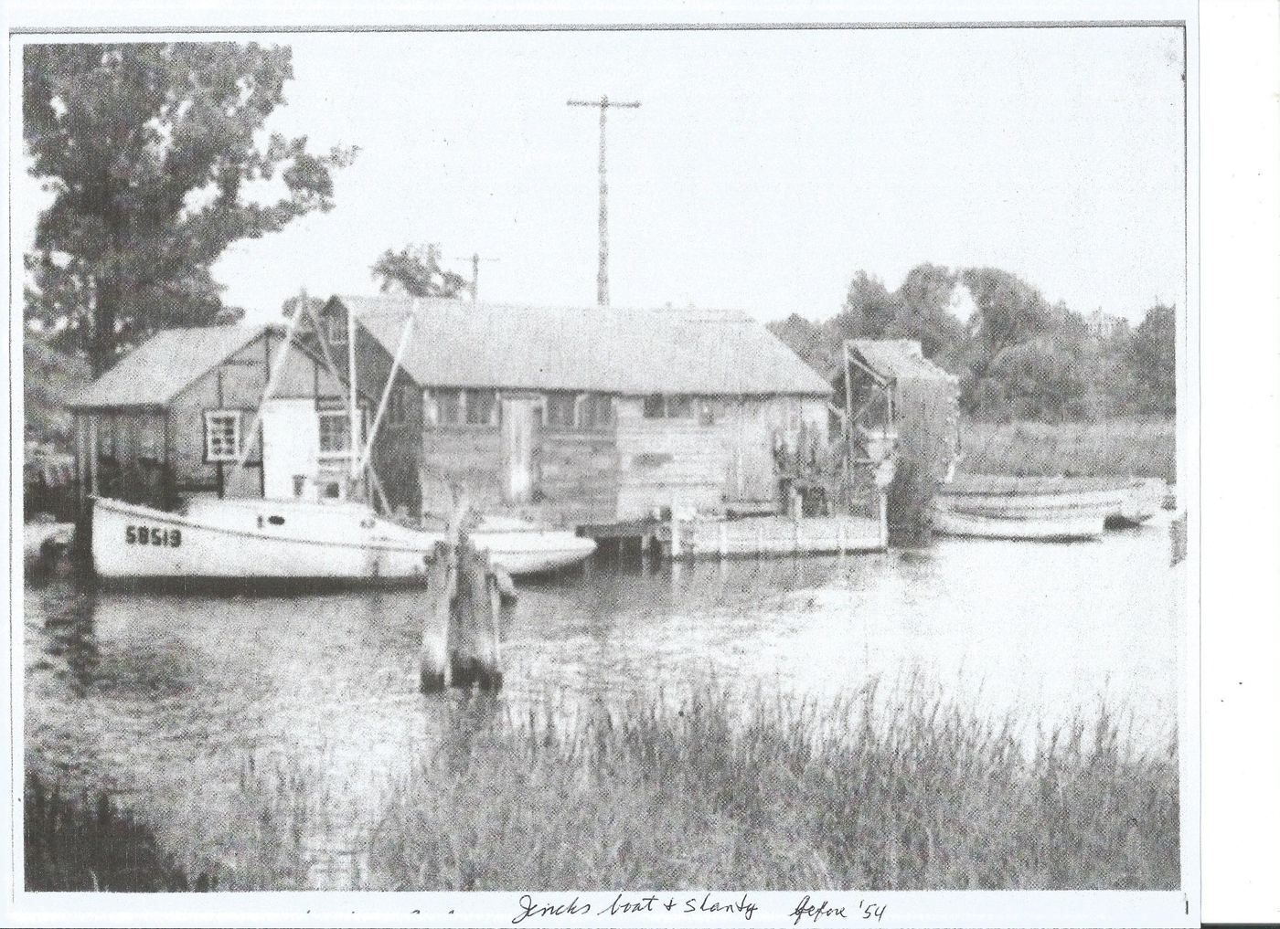
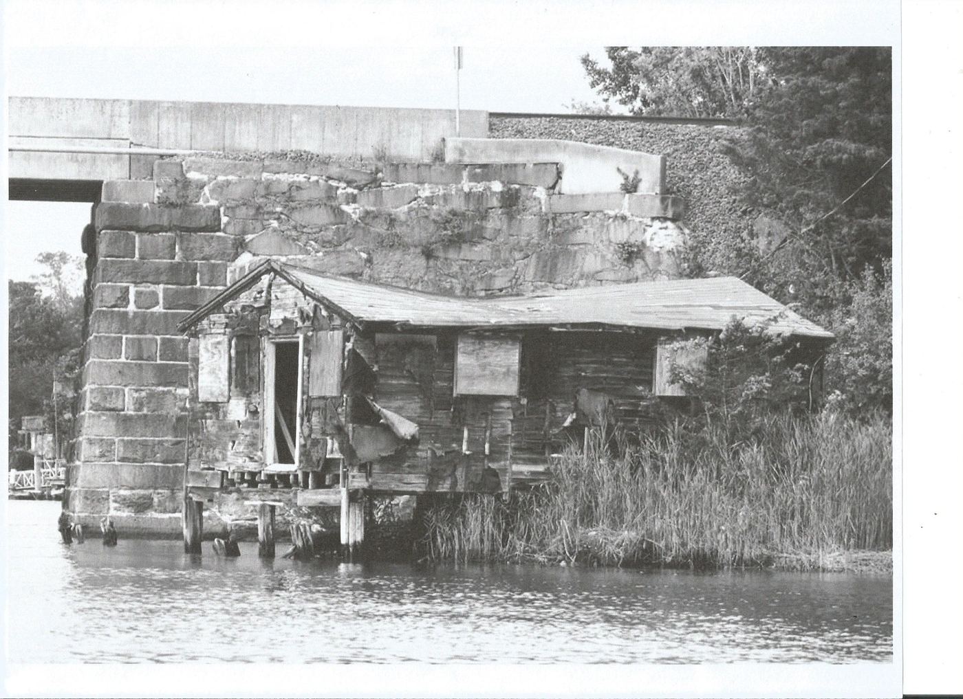
The hurricane, and the decades after it, thinned the row for good. Title to the shanties had always been informal — built as they were on filled bay land nobody quite held clear ownership of — and as the working oystermen died out, one by one, the buildings went unrepaired. A snapshot labeled "before '54" shows one still standing and still in use, a boat drawn up close beside it.
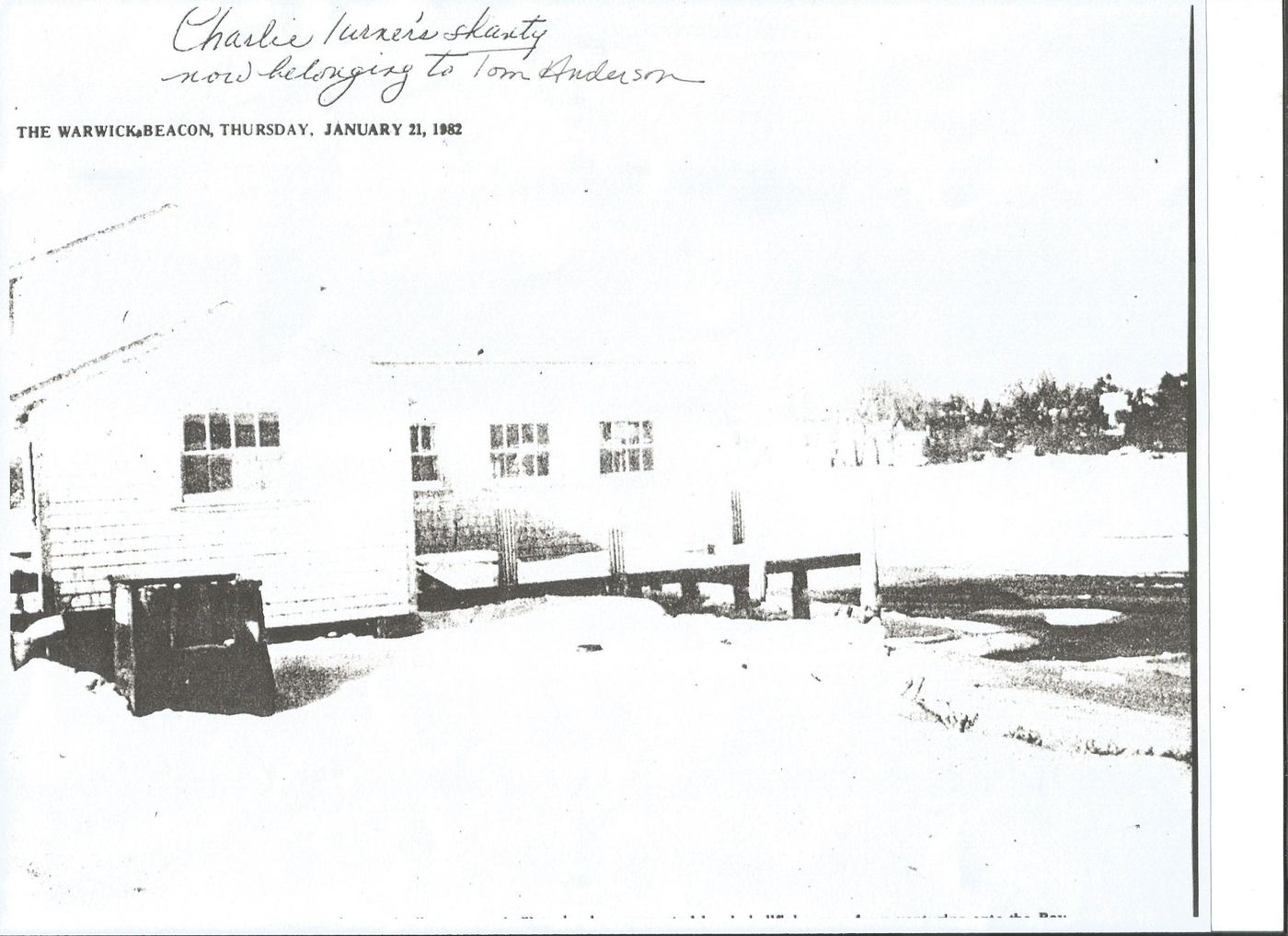
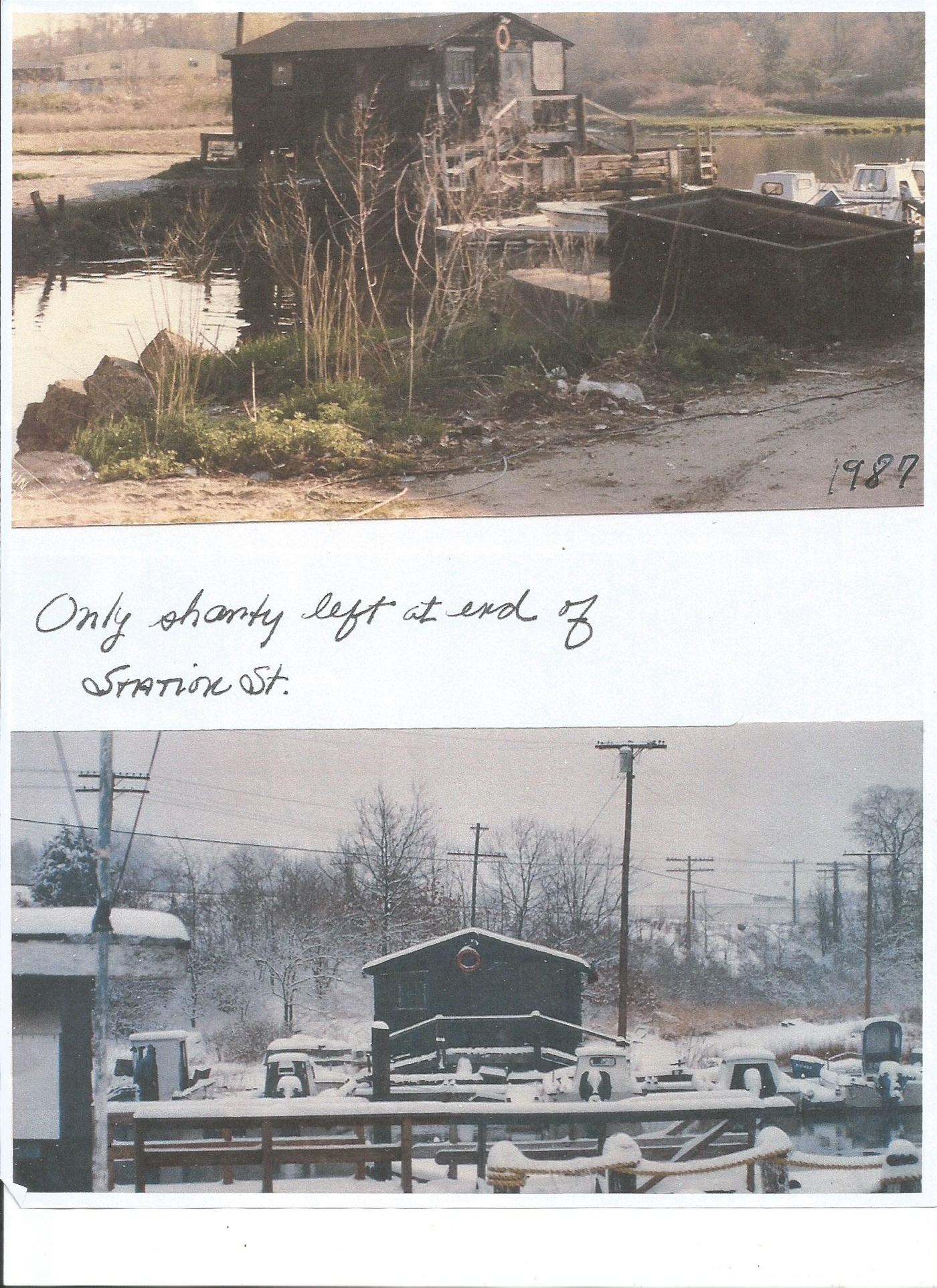
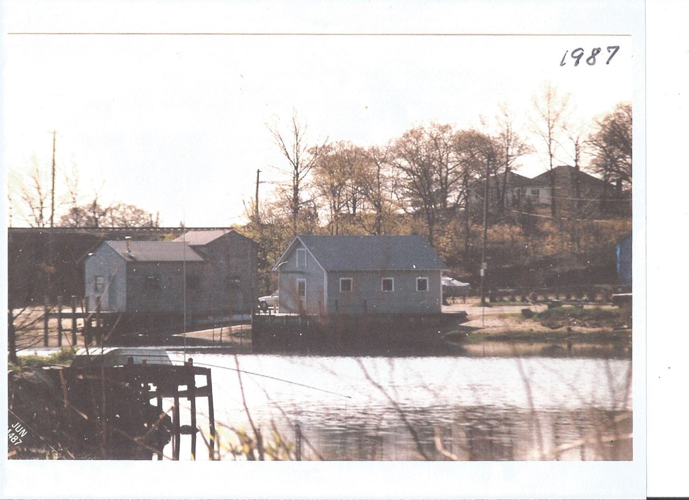
By January 1982 the Warwick Beacon could still point a reader to a single survivor at the water's edge — Charlie Turner's old shanty, by then passed to Tom Anderson. Five years after that, in 1987, only one shanty remained at all — the last building at the end of Station Street, the same Wilcox quahog-and-scallop shanty from a century before, photographed bare against the marsh grass that autumn and again buried in snow that winter, boats hauled out all around it. It came down not long after.
What the Water Kept
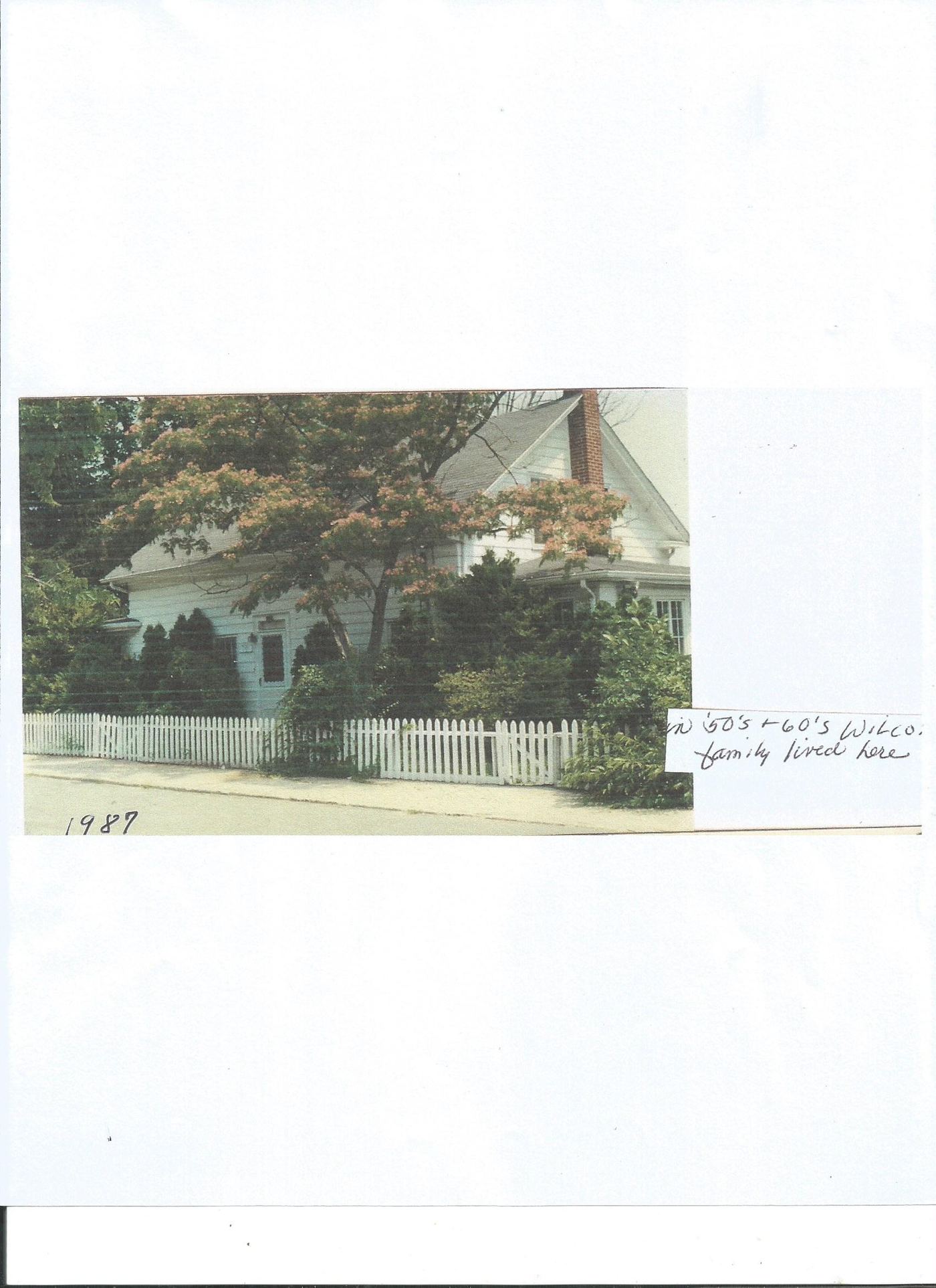
Where the Station Street shanties once stood, Ray's Bait and the Apponaug marina do business today — a straight line of use, if not of buildings, back to 1892. Some of the families are still traceable along the shore: a Wilcox house a short walk from the old shanty row, home to the Wilcox family through the 1950s and '60s, still stands behind its picket fence.
The cove itself now gives its name to Apponaug Cove, the site at the head of this same tidal inlet where new homes are taking shape — the same water the Narragansett named for its oysters some two thousand years ago, still setting the tide at the edge of the property line.
Today and the Future
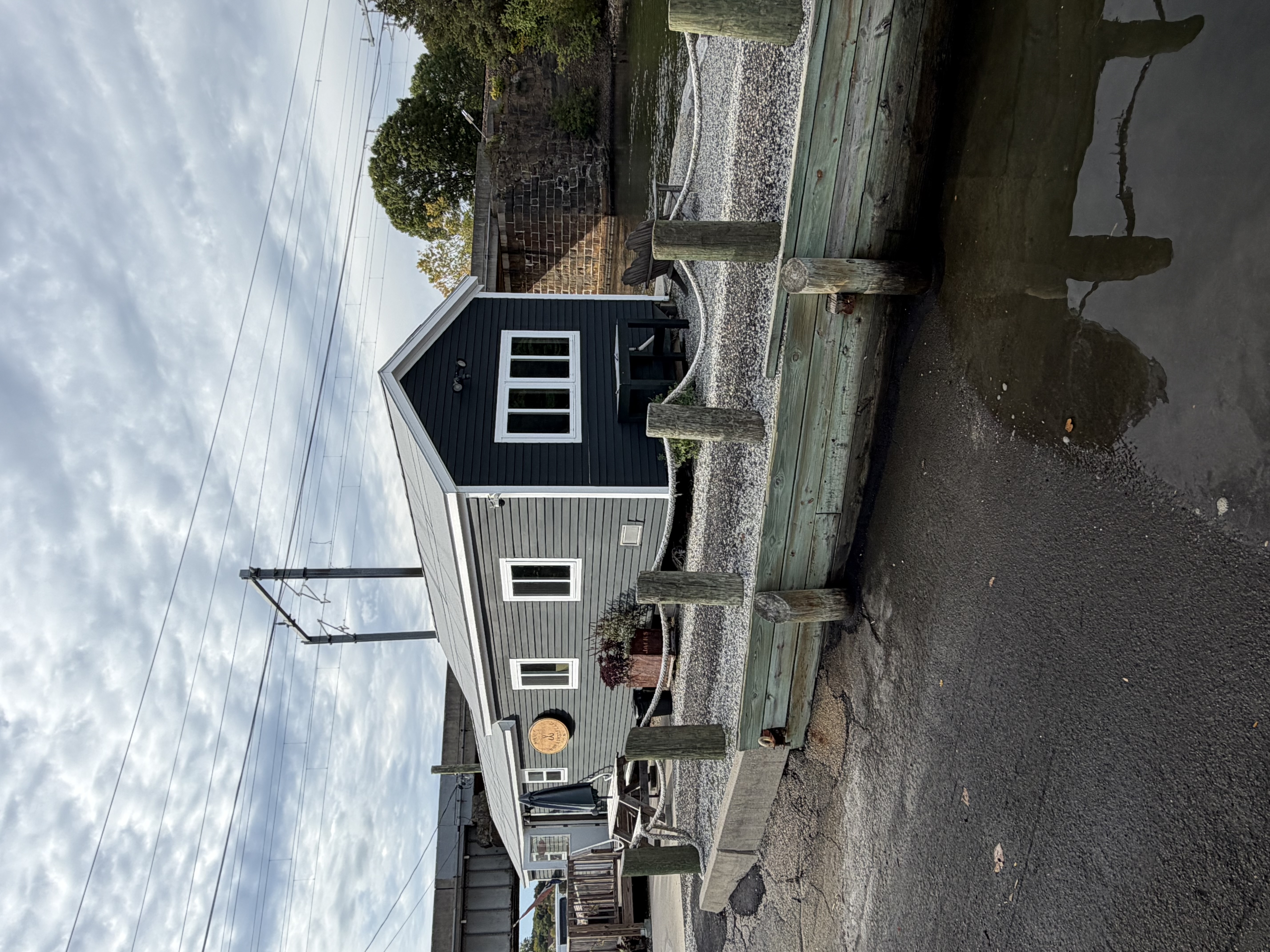
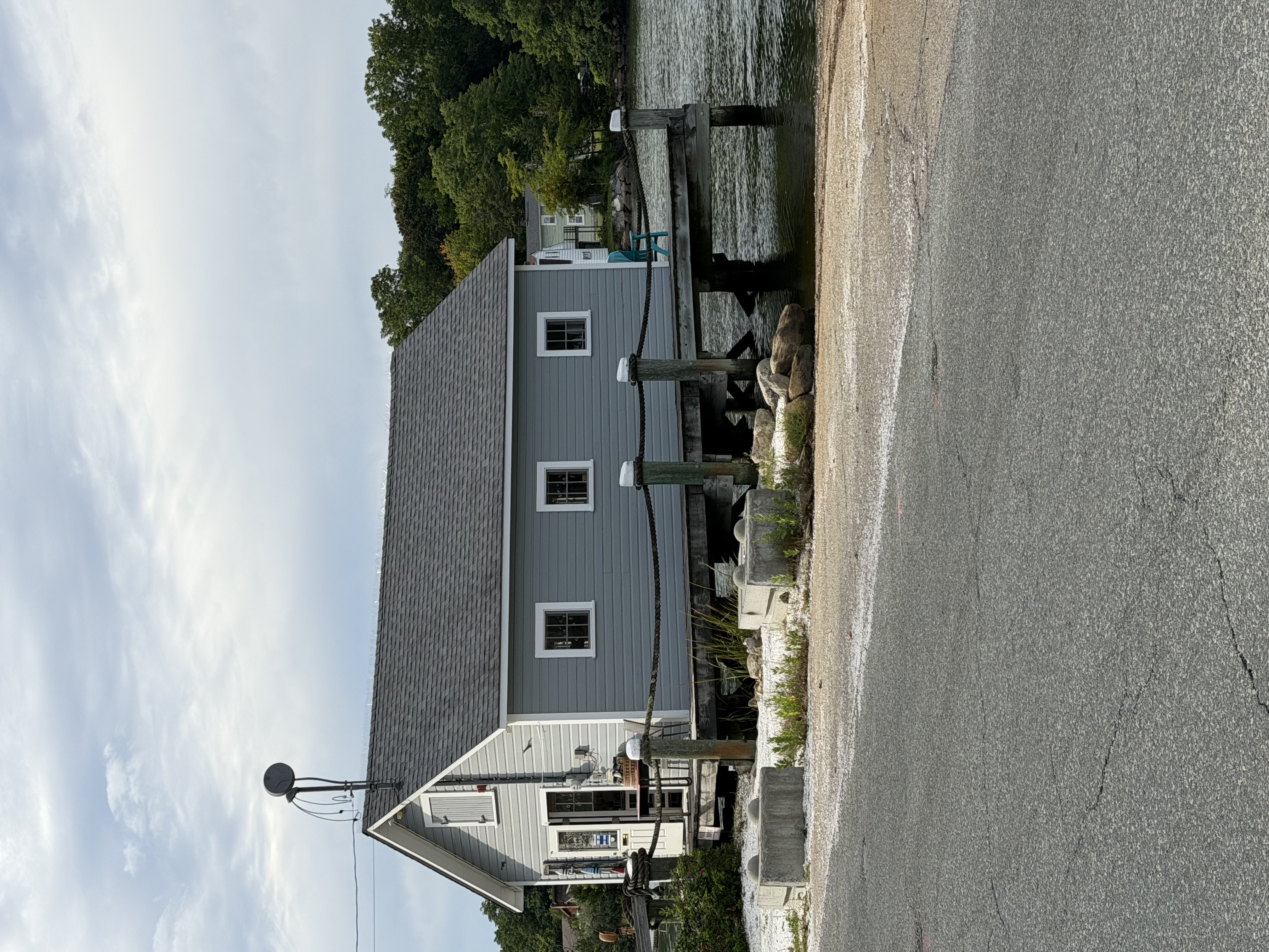
At 30 Station Street the shanty has fallen, after a moon high tide in October of 2025 broke what was left of its ocean-side pilings. It is now the "tilted" shanty, but it has survived the very hard winter of 2025–26. It has not moved more than an inch since its initial tilt off the pilings.
Currently Apponaug Cove Revitalization LLC, its current owner, has been working closely with city officials, the building department, and state and local historical societies. Plans are to disassemble and use as much as possible of the original structure in the revitalized shanty, to be rebuilt on this same historic site. The focus continues to be on keeping the usage of the shanty in the fishing industry for future generations to enjoy. The winter damage may affect those plans, but it is still a work in progress.
Current pictures of Apponaug Cove's oceanside, showing similar fishing-shanty-type structures from different angles.
The New Shanty at Station Street
It has been a long process to come up with a plan to replace or rebuild the Shanty since it became the tilted shanty after a few pilings broke. Some of this was due to the fact that the GIS map shows the property on the town road, however the actual survey puts it on 30 Station St. except for a one-foot corner on the city road. The new Shanty is planned to be one foot narrower and the same length. The structure will sit entirely on the 30 Station St. property.
The plan is to keep the structure in line with the prior historic use in the commercial fishing industry as far historic records go back. The design objective is a fishing type Shanty with a new life possibly as a shellfish pump house to run a hatchery. The intent is to help repopulate the species and also help cleanse the waters of Apponaug cove with interest from the College to use this as a satellite education opportunity. Hopefully there is support from the community and state to make it all possible.
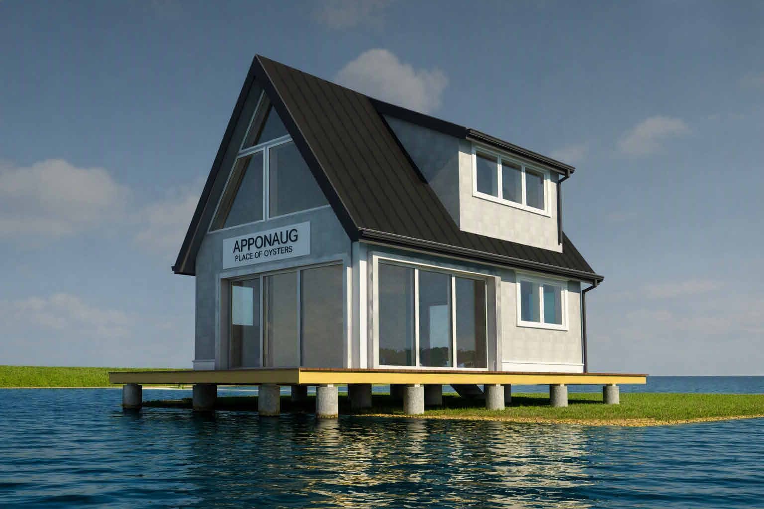
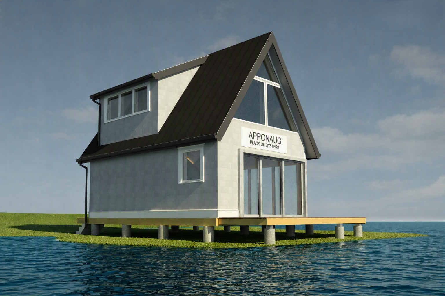
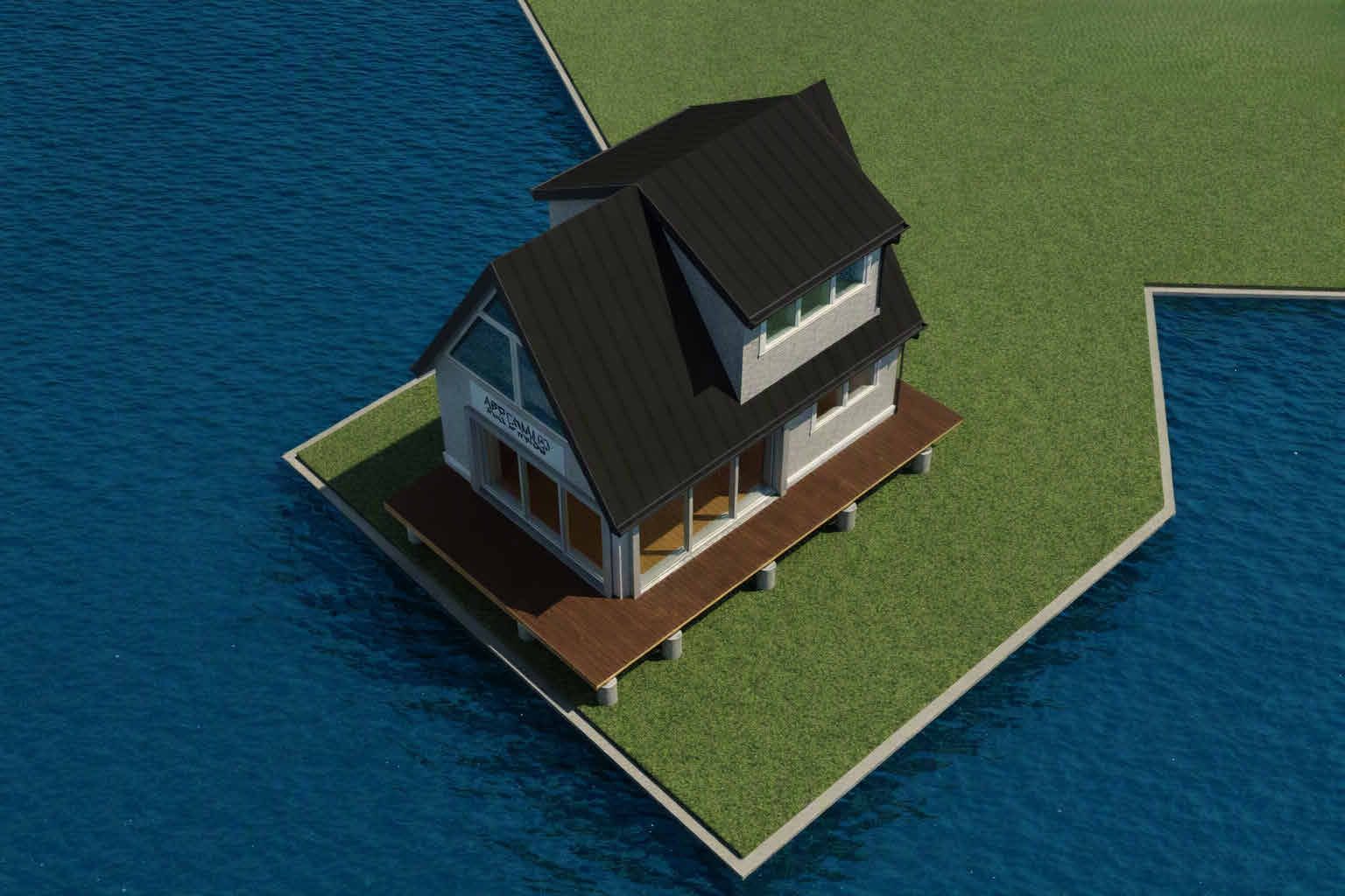
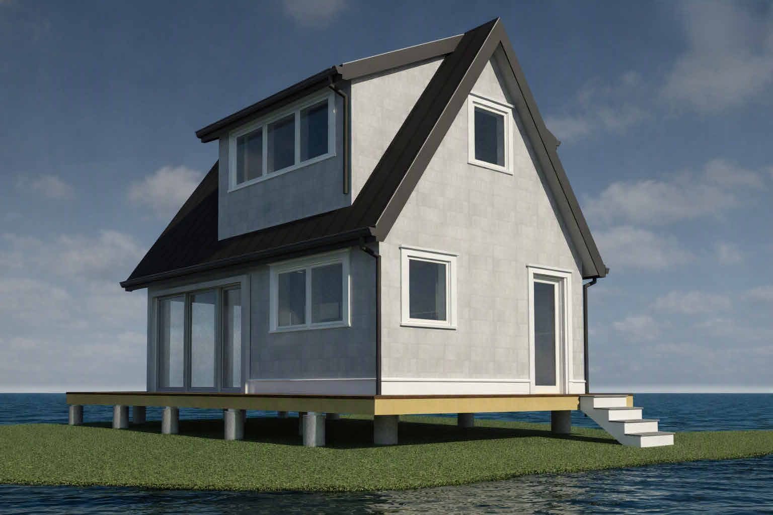
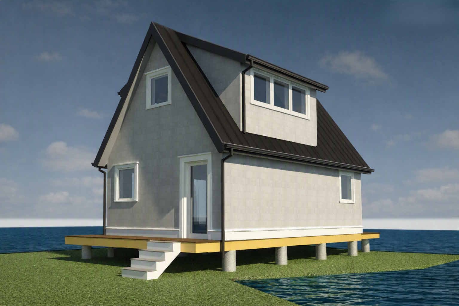
Renderings from architectural drawings dated September 23, 2026 (project 26022). Design subject to change.
Ask About the Cove
Have a memory of the shanties to add, a name or date to correct, or a question about the Apponaug Cove development taking shape on this same shoreline? Send a note below and we'll get back to you.